
At the end of the 19th century, William Frederick Cody, more popularly known as “Buffalo Bill,” achieved global celebrity through his “Wild West Show,” which toured the United States and Europe, presenting a romanticized portrayal of the American West. Before his touring shows, Cody was infamous for his skill hunting buffalo to feed railway workers during the construction of the Kansas Pacific Railroad. His “Wild West Show” cemented his celebrity, allowing him to perform for England’s Queen Victoria and meet the Pope. Beginning in 1892, his European tours took a decade-long hiatus, and he returned to America.
In the mid-1890s, Cody decided to financially invest in the growth of Wyoming: at the time, Wyoming was a brand-new state, having officially been admitted to the Union in 1890. Holt’s 1883 map of Wyoming (seen below) helps us understand how Wyoming was described in the decade before its official entry into statehood. Between 1868 and 1890, Wyoming was organized as Wyoming Territory, which had the same borders it would eventually have as a state.
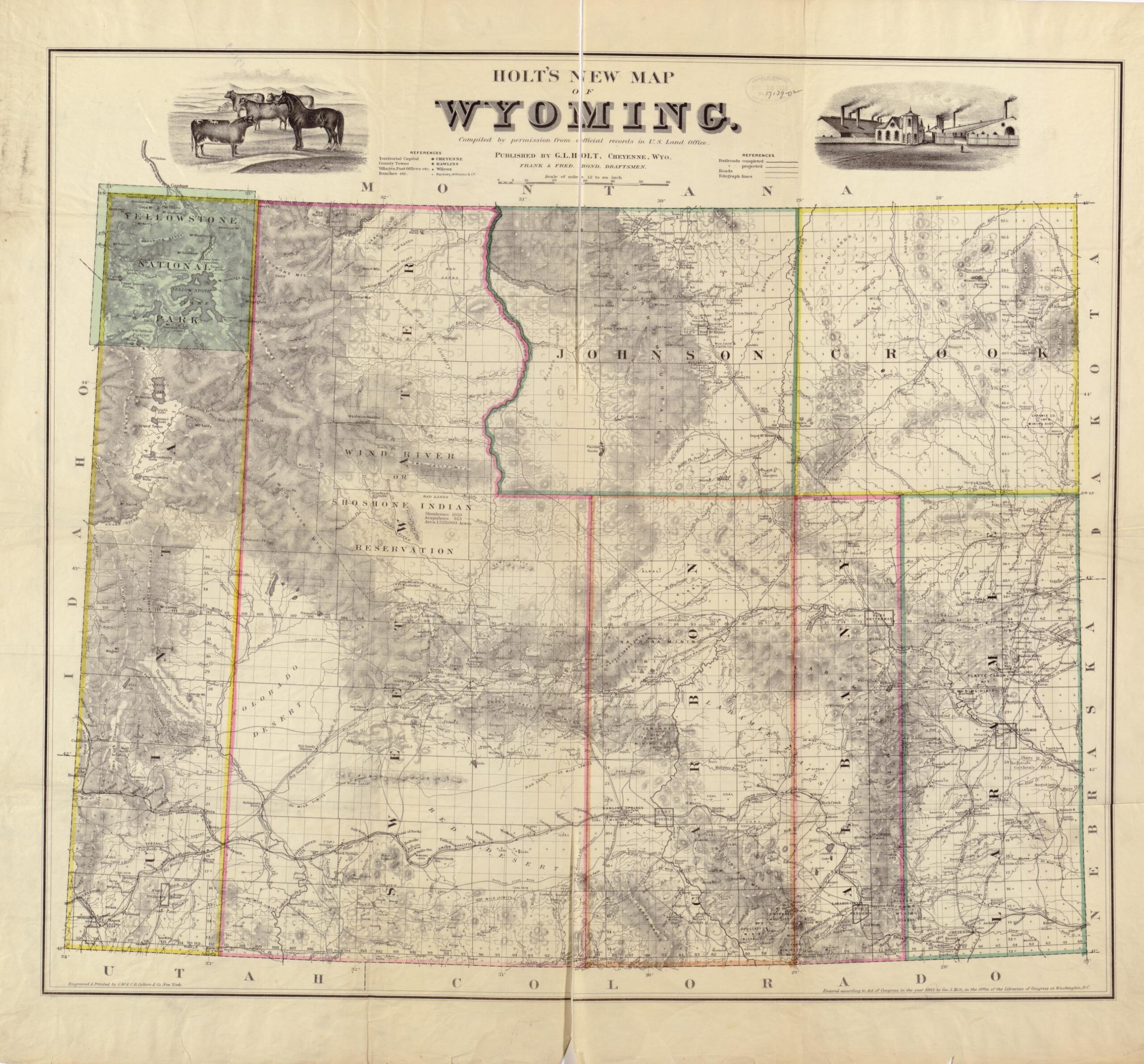
In the northwest corner of the state is Yellowstone National Park. It had already been established as the first national park in the country in 1872, well before Wyoming achieved statehood. East of the park sits the Absaroka Range, marked on the map as “Shoshone Mountains.” If we look carefully, we can find Cedar Mountain marked on the eastern edge of those mountains. Just a little bit further east of Cedar Mountain is where Cody would go on to found his namesake town of Cody, Wyoming.
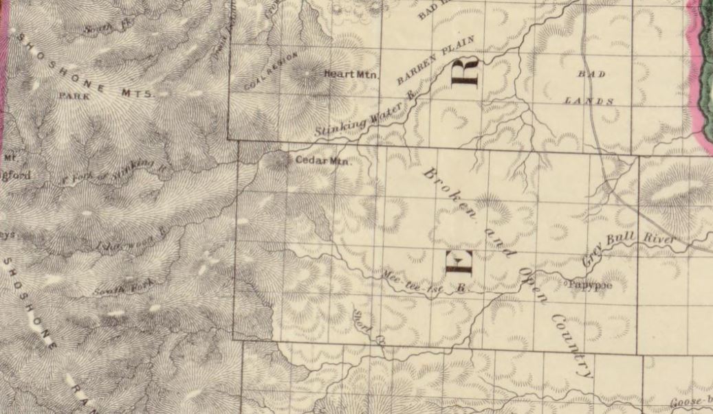
Running past Cedar Mountain toward the future site of Cody on the map is the Stinking Water River (later renamed the Shoshone River). The “Stinking Water” River is just the first of many negative-sounding places names and descriptions you see on the map describing this area: the area just north of the river, now known as the Big Horn Basin, is marked as “barren plain,” with “bad lands” to the east and “broken and open country” to the south. Even further south is the Wind River or Shoshone Indian Reservation. The founding of Cody would play out within a larger context of “reclaiming” western territory for American settlers by transforming and “civilizing” the landscape itself. Physical changes to the landscape were part of the social and cultural reclaiming of the land from a place of indigenous settlement to a space for European settlers.
In 1894, the United States Congress passed the Carey Act, which gave states the ability to sell large tracts of irrigable land to private entities, allowing them to buy land specifically for the purposes of building irrigation systems and eventually profiting from the sale of water rights. Cody’s entry into Wyoming real estate investment aligned with the passage of the Carey Act, as he partnered with investor George Beck and others to form the Shoshone Irrigation Company. Cody’s goal was to irrigate the Big Horn Basin, both creating a well-populated namesake town and securing his financial future through the sale of water rights. Cody and his business partners began construction in 1895 on the “Cody Canal,” which diverted water from the Shoshone River toward the new town of Cody, before getting official approval through the Carey Act. The project didn’t go well – construction costs ultimately clocked in at twice their estimated price, the physical construction of the canal was difficult, settlers to the area were fewer than expected, and Cody residents were unhappy with the quality of the water. By 1898, the company was actively trying to sell the project. The Burlington and Missouri River Railroad construction eventually connected the new town of Cody to a transportation system in 1901, allowing the settlement rate in the area to tick up, but the canal itself only irrigated a small portion of the Big Horn Basin, and not particularly well.
The passage of 1902’s Reclamation Act allowed for federal funding for large-scale irrigation projects in western states. By 1904, Cody gave up on his private investment and assigned his water rights to the federal government, and thus began the Shoshone Reclamation Project.
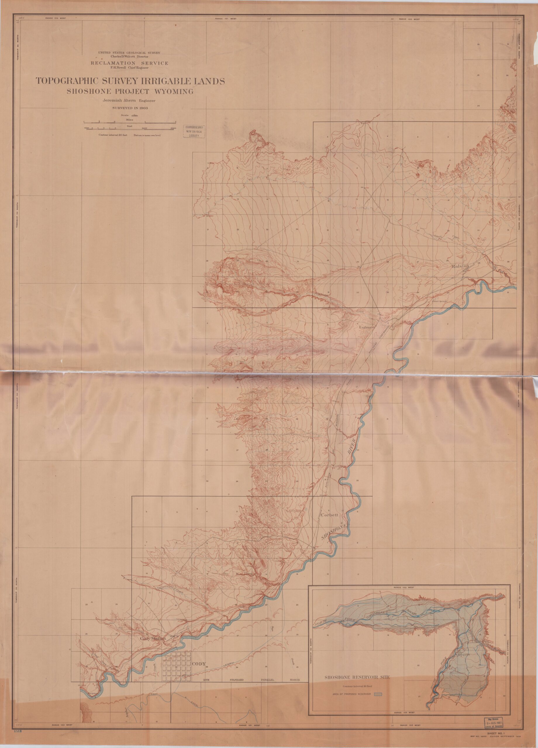
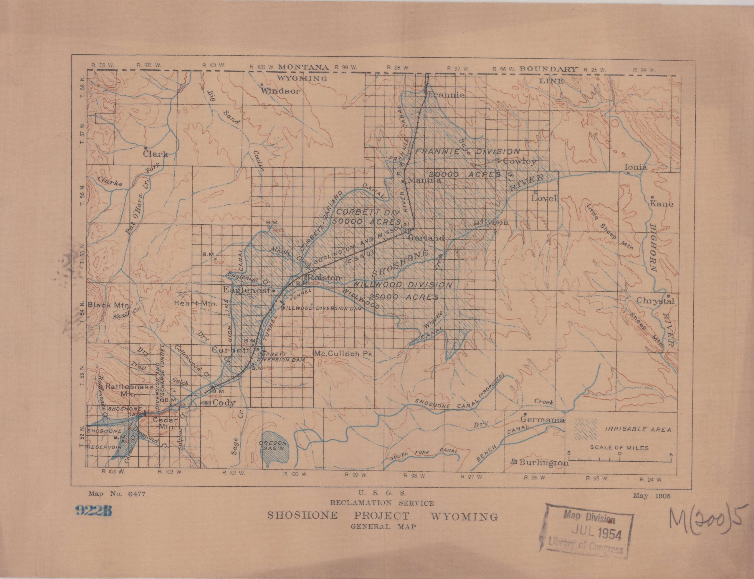
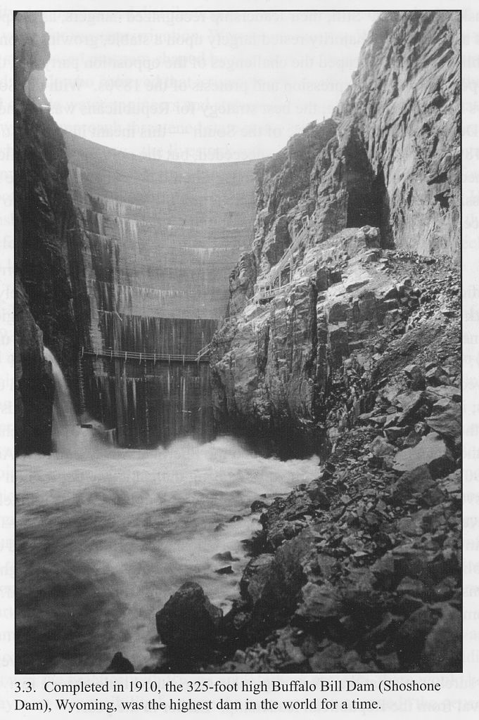
The Reclamation Service decided that the best function of the Shoshone River would be to build a dam west of Cody. Dam construction began in 1904 and was completed by 1910. The 1905 map below outlines the project plan at that time, with the dam located at Cedar Mountain.
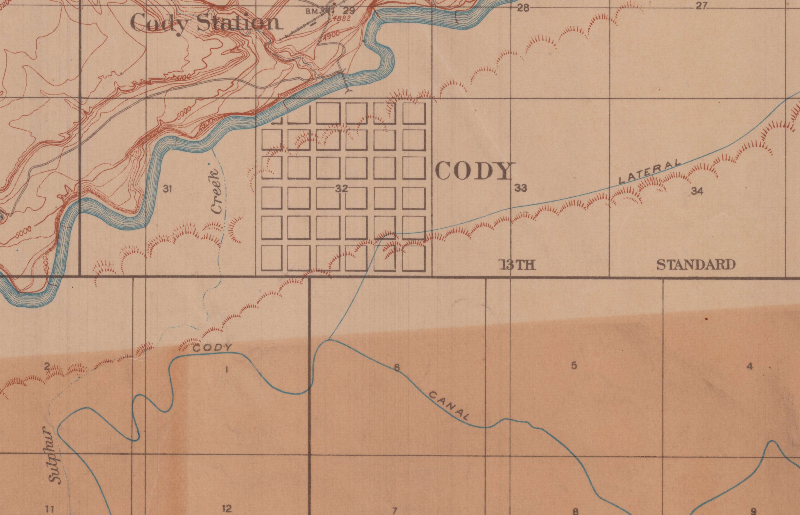
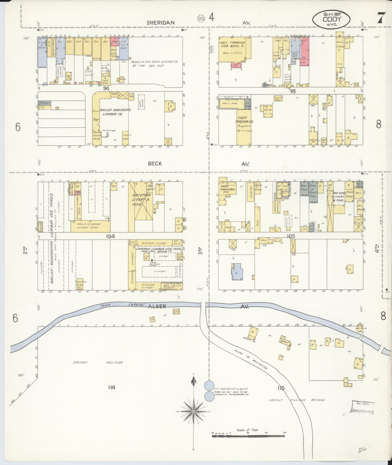
In his article “Elwood Mead, Buffalo Bill Cody, & the Carey Act in Wyoming,” published in Montana: The Magazine of Western History,” Robert Bonner argues that it was Cody’s private business failure that helped establish a solid case for federal intervention in reclamation projects. Cody was left to other business ventures, including the establishment of Cody’s Irma Hotel and the continuation of his “Wild West” tours. His final European tour took place in 1906, during dam construction. Cody, Wyoming is documented in the 1907 Sanborn Fire Insurance map below, which shows the town lateral (from the Cody Canal) running at the edge of the city. The Cody Canal still exists and can be found running south of the city of Cody.
By 1910, the Shoshone Dam construction was complete: at the time of construction, it was the tallest dam in the world. Some of the soil difficulties that plagued the Cody Canal resurfaced with the dam itself, which struggled with silt-related issues. In 1946, the dam was renamed to honor Cody, and is now known as the Buffalo Bill Dam.
Sources & Further Reading:
- “Elwood Mead, Buffalo Bill Cody, & The Carey Act in Wyoming” in Montana: The Magazine of Western History, by Robert. E. Bonner. [Vol 55, Issue 1. Spring 2005.]
- “William F. Cody’s Wyoming Empire: The Buffalo Bill Nobody Knows,” by Robert E. Bonner.
- Buffalo Bill: Topics in Chronicling America