
Ahupua’a are types of land divisions from ancient Hawai’i that typically ran from the mountains (mauka) towards the sea (makai) containing a cross section of island resources needed to support a community led by an ali’i ‘ai (chief) and managed by a konohiki (overseer and tax collector).
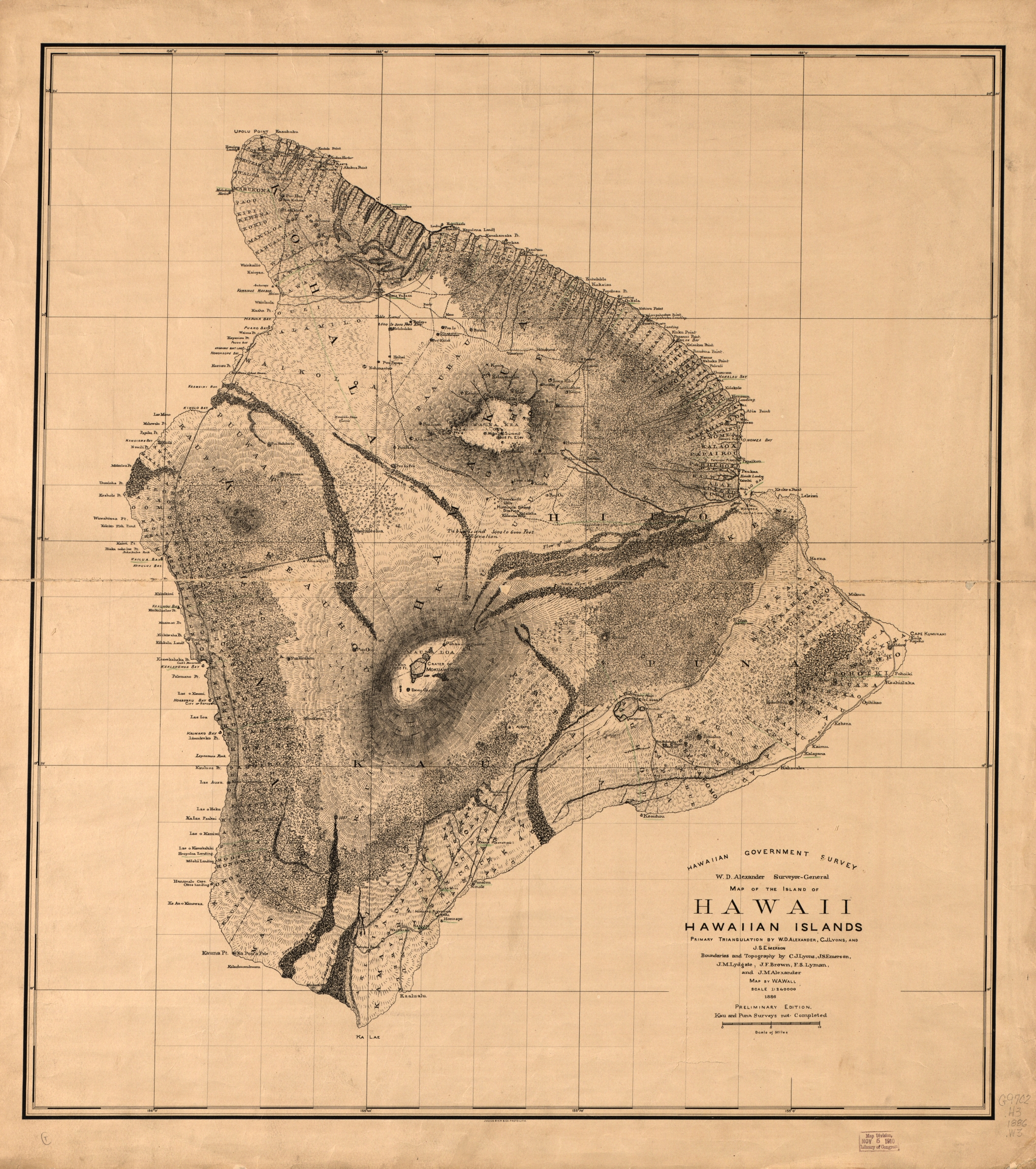
In the above, ahupua’a can be identified in large capital letters on land in the mauka to makai orientation (generally from a coastal point toward the center of the island). Ahupua’a were the main type of land division although there were smaller subdivisions of ahupua’a called ‘ili, usually worked by one extended family, and larger districts called moku made up of several ahupua’a. The largest and most general division was called mokupuni, which was the equivalent of an island. On the map below you can see the moku of Puna, Hilo, Hamakua, Kohala, Kona, and Kau on the mokupuni of Hawai’i.
The Hawaiian word ahupua’a is a combination of ahu, meaning cairn or pile of rocks, and pua’a meaning pig. Ahupua’a boundaries were often marked by a pile of stones that also served as place where tribute to the ahupua’a ali’i was placed-often a pig. This boundary usually conformed to watersheds as can be seen in the on the map below covering the moku of Hilo on the mokupuni of Hawai’i. The Umauma stream forms the border between the Umauma and Kama’e’e ahupua’a, the Hakalau and Waawaa streams form the border between the Kama’e’e and Hakalau ahupua’a, and the Kolekole stream forms the border between Kaiwikinui and Wailea ahupua’a to the north and Kahua and Honomu ahupua’a to the south.

Based on a Geographic Information Systems (GIS) dataset of ahupua’a boundaries developed by the Office of Hawaiian affairs who reconstructed the boundaries from 19th century survey maps, there were 725 ahupua’a across all eight mokupuni, averaging about 5,678 acres in size with the largest ahupua’a measuring 223,477 acres. Further examination with the Shuttle Radar Topography Mission (SRTM) Digital Elevation Model (DEM) set for the state of Hawaii reveals an average ahupua’a elevation range of 2,995 feet (typically starting at sea level) with an average max elevation of 3,100 feet. On larger and higher elevation mokupuni such as Hawai’i (max elevation 13,803 feet) and Maui (max elevation 10,023 feet), the highest ahupua’a elevation or mauka border typically stopped at the timberline.
A typical ahupua’a usually started on the coast and even extended out into the ocean for access to aquatic resources. Many ahupua’a also contained constructed fishponds on the coast for aquaculture. According to Keli‘i Kotubetey, Hawaiian fishponds could produce up to 300 lbs. of fish per acre per year. The aerial photograph below shows one of the bigger fishponds that still exists on the mokupuni of Hawai’i, Kona moku, Kaloko ahupua’a.
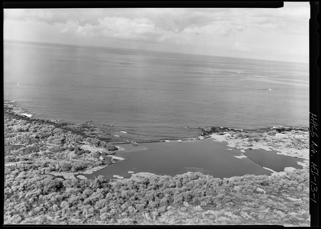
The map below shows the location of the Kaloko Fishpond (currently a National Historic Park) in the Kaloko ahupua’a with the neighboring Honokohau Fishpond to the south. Several ahupua’a boundaries appear on this large scale map delineated by dashed lines.

It was common for the makai residents of an ahupua’a to trade coastal resources that were abundant such as fish, opihi (limpet shellfish), shark teeth, lauhala (leaves of the hala tree) and niu (coconut) with resources from more makua or inland residents like mai’a (bananas), taro, ‘uala (sweet potato), ulu (breadfruit), māmaki (pipturus), or wood. The endemic māmaki grew at a 200-6,000 foot range and could be used for medicine using the fruit or to make kapa cloth from the bast fibers. Hard wood from the ‘ohi’a lehua tree, growing up to an elevation of 8,000 feet, was often used to make kapa cloth beaters or weapons like ihe (spears). One of the more intriguing Hawaiian weapons was the leiomano or shark tooth club, which was made of a hard wood such as acacia koa (found between 300-6000 feet) and shark teeth lashed with olonā (Touchardia) found between 229 to 3,937 feet. Fibers from the endemic olonā contain very strong fibers and were also used by early Hawaiians as cordage, fishing line, nets, twinned fish baskets, stitching for kapa cloth, and for tying stone adze heads to wooden handles. As one of the largest hard wood trees in Hawai’i, koa was also a commonly used wood for the construction of outrigger or double hulled wa’a (canoes) which could reach up to 100 feet long. The smaller and shorter canoes were typically used for fishing with the longer and larger ones used for inter-island navigation.
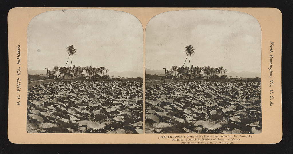
Early Hawaiians practiced irrigated farming cultivating taro in ponds along valley floors or terraces built on valley slopes by diverting water from nearby streams in their ahupua’a. Rainfed cultivation of plants such as dry taro, ‘uala, and kō (sugarcane) could be found at various elevations. Domesticated ʻilio (dog), moa (chicken), and pua’a brought by Polynesians to Hawai’i provided additional protein to the diet besides seafood and their bones were used to fashion fishing hooks.
At the mauka extremes on high elevation mokupuni such as Hawai’i and Maui could be found more unique ahupua’a resources. The mauka side of Kaʻohe ahupua’a in the moku of Hamakua and Kohala, mokupuni of Hawai’i and covering the summits of the island’s two highest mountains (Mauna Kea and Mauna Loa) contained burrow or rock crevice nests above 8,200 feet of the ‘ua‘u (Hawaiian petrel). According to the Hawaii Department of Natural Resources, the chicks of this pelagic and currently endangered bird was a Hawaiian delicacy. Another currently endangered bird used by early Hawaiians in this ahupua’a was the palila (finch-billed Hawaiian honeycreeper), but it wasn’t used for food due to their small populations. Early Hawaiians prized the yellow feathers of the palila for hulu manu (featherwork) found in ahu`ula (cloaks), kāhili (royal standards) and leis (garlands) of the ali’i. Rather than kill the palila for all its feathers, they would instead trap the bird on tree branches with sticky sap from the ulu tree, pluck a few feathers, then let the bird free. The branches the palila were trapped on were often part of the endemic māmane since this tree was the main food source of this bird. Wood from the māmane tree, found between 1,400 to 10,000 feet elevation, was also used for o’o (digging stick), wa’a gunwales and papa hōlua, a Hawaiian sled used in the extreme sport of he’e hōlua (sled riding) which utilized the wide elevation range of many ahupua’a.
The mauka Kaʻohe ahupua’a was also the site of one of the most important resources to early Hawaiians- basalt. This hard volcanic rock could be found at an adze quarry on Mauna Kea where early Hawaiians fashioned stone tools- primarily adzes which were used to cut down trees, shape wa’a, weapons, furniture, and kiʻi (wooden idol statues). This 7.5 mile area situated between 8,600 and 13,000 feet elevation is currently part of the Mauna Kea Ice Age Natural Area Reserve and according to the National Park Service the largest primitive rock quarry in the world.

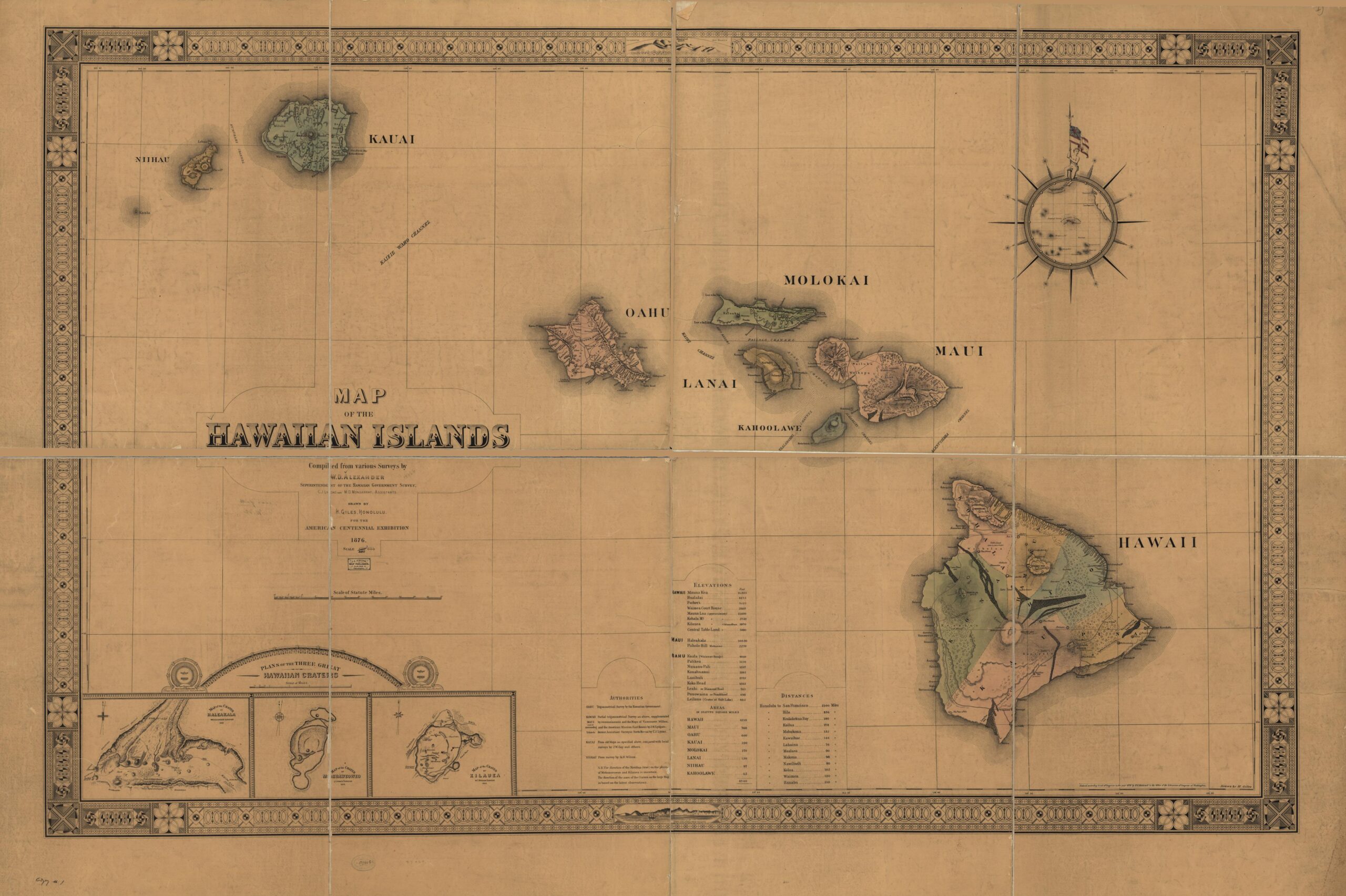
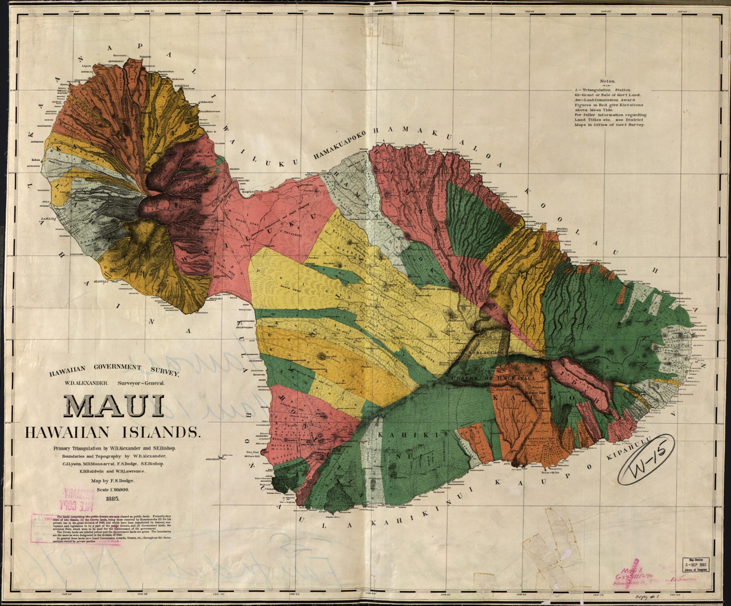
The ahupua’a system of land tenure lasted until 1848 when the Kingdom of Hawai’i implemented the Great Mahele, which changed the land tenure system to fee simple, allowing for private ownership. The map below shows the 40,000 acre grant 3343 in the Wailuku ahupua’a at the neck of the island which was bought and leased by German-American sugar industrialist Claus Spreckels, who according to Char Miller, by 1892 had the largest sugarcane plantation in the world. Sugar industry interests eventually overthrew the Hawaiian Kingdom in 1893.
Further Reading:
- Holua sledding, the death-defying sport of Hawaiian chiefs – Hawaii Magazine
- IslandBreath: Hawaiian Ahupuaa
- Native Plants Hawaii
- The Garden – Friends of Amy B.H. Greenwell E. Garden (amygreenwell.garden)
- traditional tools | hemakeewaa
- A Story Of Ancient Hawaiian Culture On The Slopes Of Haleakala (tourmaui.com)
- Introduction – Maps by State: Cartographic Resources for Hawaii – Research Guides at Library of Congress (loc.gov)