, hot hydrogen gas (blue), and cosmic dust (red).")

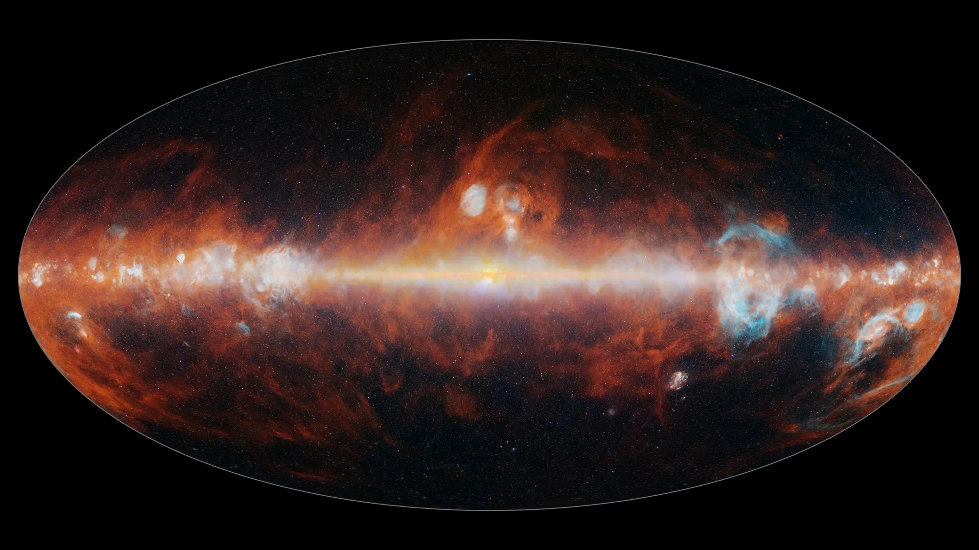
NASA’s SPHEREx Observatory has mapped the entire sky in 102 infrared colors, as seen here in this image released on Dec. 18, 2025. This image features a selection of colors emitted primarily by stars (blue, green, and white), hot hydrogen gas (blue), and cosmic dust (red).
Read More

