

In 1631, he introduced his inaugural atlas, showcasing roughly 60 maps accompanied by detailed texts. Among these maps, 13 originated from Blaeu’s previous releases, while an additional 37 copper plates obtained from Jodocus Hondius in 1629 enriched the atlas. Initially dubbed the “Appendix,” this endeavor aimed to complement the established atlases of Ortelius and Mercator. Within a year, it expanded into two parts, boasting a total of 99 maps, and underwent further expansion and refinement in subsequent years.
History, Art, Map, Vintage, Exploration, cartography, USA, Colonial, Willem Blaeu, Early Map,
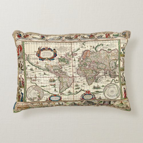
This publication sparked a fierce rivalry between Blaeu’s establishment and that of Hondius/Janssonius. The latter promptly began reproducing maps procured from Jodocus II, integrating them into their editions of the renowned Mercator-Hondius atlases, thus initiating a trend of reciprocal replication. In 1634, the atlas underwent a name change to “Theatrum Orbis Terrarum” (Theatre of the World), in homage to Ortelius’ groundbreaking atlas of 1570. The inaugural single-volume edition, in German, featured 159 maps, cementing its status as a comprehensive atlas. Subsequent translations into Dutch, French, and Latin led to a renewed division into two parts, showcasing approximately 208 maps. This expansive atlas experienced further expansion and refinement, evolving into a continually growing multi-part compilation.
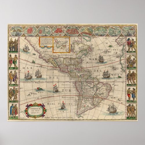
#history, #art, #map, #Exploration, #cartography, #reproduction, #exploration, #tycho – Following Willem Jansz.’s demise, the atlas persisted in its evolution, eventually earning the title Atlas Maior, Grooten Atlas, or Geographiae Blavianae. Throughout the 17th century, it emerged as one of the most expansive and opulent publications in cartography. Editions comprised up to 14 distinct volumes and contained around 600 maps, solidifying its reputation as a pinnacle of cartographic achievement.